Pirep is a free, collaborative database of all public and private airports. All pilots are welcome to contribute their local knowledge to any airport, no registration required.
No upcoming events. Is anything happening here soon?
Last updated: 2023-12-10 02:18:50 PST
Last updated: 2025-07-16 09:56:58 PDT
Last updated: 2024-02-14 22:40:11 PST
Airport Statistics
- Landing & tie-down fees
- WiFi availability
- Transient parking location
Location:
Salem, OR
Elevation:
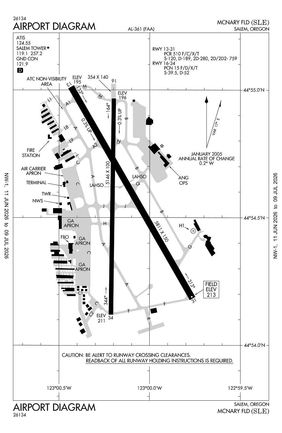
213ft
Sectional:
Seattle
Activation date:
Nov 1937
Fuel:
100LL, A (prices)
Runway 13/31:
5,811ft
Runway 16/34:
5,146ft
Runway H1:
37ft
Access: Open to the public
Similar Airports

Current Weather — VFR
-
Weather data is strictly informational and not for flight planning purposes.
-
METAR2026-07-28 19:56:00 PDT
Ceiling: Sky clear Wind: 290° @ 10kt Temperature: 71°F Dewpoint: 55°F Weather: N/A Visbility: 10SM Raw:METAR KSLE 290256Z 29010KT 10SM CLR 22/13 A3000 RMK AO2 SLP156 T02220128 55005 -
TAF2026-07-28 17:00:00 PDT – 2026-07-29 00:00:00 PDT
Ceiling: Sky clear Wind: 300° @ 9kt Weather: N/A Visbility: 6SM Clouds: Scattered @ 7,000ft Raw:TAF KSLE 282326Z 2900/2924 30009KT P6SM SCT070 FM290700 33003KT P6SM BKN060 FM291600 01005KT P6SM SKC -
TAF2026-07-29 00:00:00 PDT – 2026-07-29 09:00:00 PDT
Ceiling: 6,000ft Wind: 330° @ 3kt Weather: N/A Visbility: 6SM Clouds: Broken @ 6,000ft Raw:TAF KSLE 282326Z 2900/2924 30009KT P6SM SCT070 FM290700 33003KT P6SM BKN060 FM291600 01005KT P6SM SKC -
TAF2026-07-29 09:00:00 PDT – 2026-07-29 17:00:00 PDT
Ceiling: Sky clear Wind: 010° @ 5kt Weather: N/A Visbility: 6SM Clouds: @ ft Raw:TAF KSLE 282326Z 2900/2924 30009KT P6SM SCT070 FM290700 33003KT P6SM BKN060 FM291600 01005KT P6SM SKC
Click/tap to add an annotation marker to the map
No webcams added yet.
Remarks
- Estbd prior to 1959.
- Ppr for unsked acr ops gtr than 30 pax seats - amgr.
- Bird haz: waterfowl invof arpt; geese trsn class d tpa oct-may.
- Twy a fm twy l to l9 not vsb fm atct.
- Self fueling, 100ll only, avbl 24 hrs a day. jet a avbl aft nml bus hrs with advnd notice at 503-508-4178 or 503-364-4158.
Comments