Pirep is a free, collaborative database of all public and private airports. All pilots are welcome to contribute their local knowledge to any airport, no registration required.
No upcoming events. Is anything happening here soon?
Last updated: 2023-04-14 15:44:47 PDT
Last updated: 2024-03-19 19:29:24 PDT
Airport Statistics
- Webcam links
- Airport map annotations
- Fuel pump location
Location:
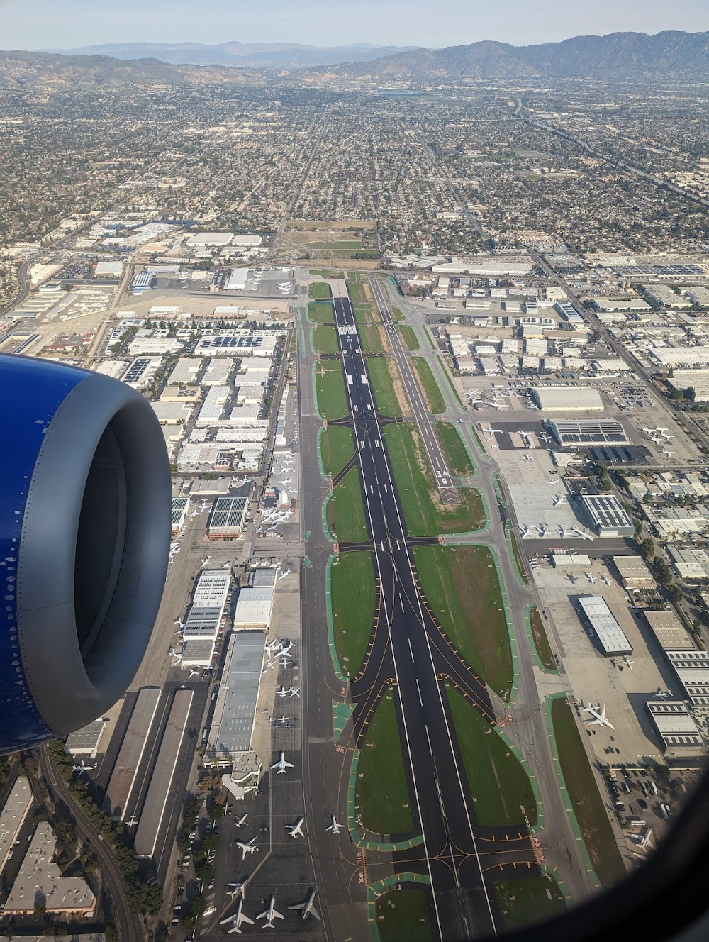
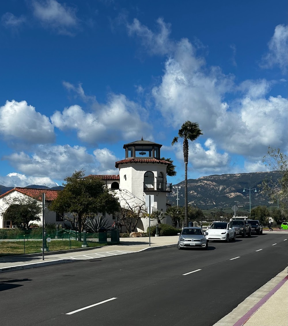
Van Nuys, CA
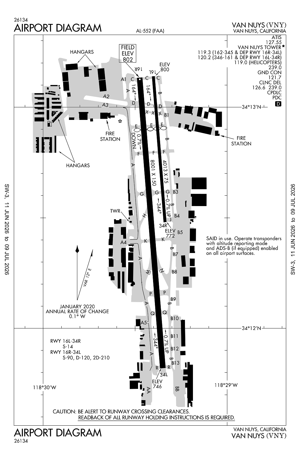
Elevation:
802ft
Sectional:
Los Angeles
Activation date:
Jul 1942
Fuel:
100LL, A (prices)
Runway 16R/34L:
8,001ft
Runway 16L/34R:
4,013ft
Access: Open to the public
Similar Airports
Current Weather — MVFR
-
Weather data is strictly informational and not for flight planning purposes.
-
METAR2026-07-29 05:51:00 PDT
Ceiling: 1,100ft Wind: 120° @ 3kt Temperature: 66°F Dewpoint: 62°F Weather: N/A Visbility: 9SM Clouds: Overcast @ 1,100ft Raw:METAR KVNY 291251Z AUTO 12003KT 9SM OVC011 19/17 A2987 RMK AO2 SLP103 T01940172 -
TAF2026-07-29 05:00:00 PDT – 2026-07-29 09:00:00 PDT
Ceiling: 1,000ft Wind: Variable Weather: N/A Visbility: 6SM Clouds: Broken @ 1,000ft Raw:TAF KVNY 291128Z 2912/3012 VRB03KT P6SM BKN010 FM291600 VRB03KT P6SM SKC FM292200 15010KT P6SM SKC FM300200 11006KT P6SM SKC -
TAF2026-07-29 09:00:00 PDT – 2026-07-29 15:00:00 PDT
Ceiling: Sky clear Wind: Variable Weather: N/A Visbility: 6SM Clouds: @ ft Raw:TAF KVNY 291128Z 2912/3012 VRB03KT P6SM BKN010 FM291600 VRB03KT P6SM SKC FM292200 15010KT P6SM SKC FM300200 11006KT P6SM SKC -
TAF2026-07-29 15:00:00 PDT – 2026-07-29 19:00:00 PDT
Ceiling: Sky clear Wind: 150° @ 10kt Weather: N/A Visbility: 6SM Clouds: @ ft Raw:TAF KVNY 291128Z 2912/3012 VRB03KT P6SM BKN010 FM291600 VRB03KT P6SM SKC FM292200 15010KT P6SM SKC FM300200 11006KT P6SM SKC -
TAF2026-07-29 19:00:00 PDT – 2026-07-30 05:00:00 PDT
Ceiling: Sky clear Wind: 110° @ 6kt Weather: N/A Visbility: 6SM Clouds: @ ft Raw:TAF KVNY 291128Z 2912/3012 VRB03KT P6SM BKN010 FM291600 VRB03KT P6SM SKC FM292200 15010KT P6SM SKC FM300200 11006KT P6SM SKC
Click/tap to add an annotation marker to the map
No webcams added yet.
Remarks
- This airport has been surveyed by the national geodetic survey.
- Ry 16l/34r clsd & unlgtd when tower closed.
- Extreme noise sensitive area.
- Noise ordinance curfew: no tkofs for acft exceeding 74 dba (per ac36-3) btn 2200-0700; excp military; mercy flights & law enforcement acft.
- Arpt clsd to air carrier opns.
Comments